


Hurricane Idalia- Devastating tropical cyclone (Category-4) having potential ‘the possibility of death and major destruction and categories.
In the USA, tropical cyclones strike roughly 12 times per year on average. The three years with the most hurricanes, each with over 20, were 1933, 2005, and 2020. Hurricanes on the East Coast are significantly stronger and more frequent, while the West Coast is rarely affected.
Beginning in early June and ending in late November is the Atlantic hurricane season. It starts a little bit sooner in the Pacific.
Ian was the most powerful storm to hit the United States in the previous 12 months. On September 28, 2022 at 8:00 am local time, it was 119 kilometers across and had a wind speed of up to 259 km/h near Sanibel. Saffir-Simpson, a widely-accepted measurement tool.
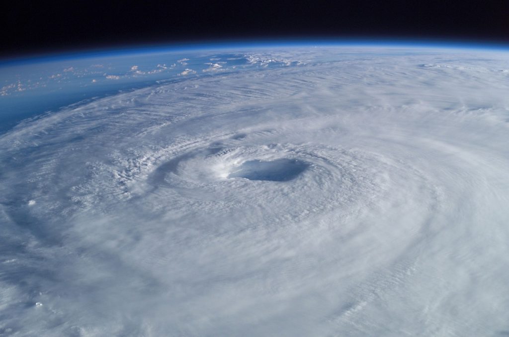
Tropical cyclones, often known as typhoons or hurricanes, are powerful circular storms with low air pressure, strong winds, and heavy rain that develop over warm tropical oceans. A tropical cyclone produces winds that exceed 119 km (74 miles) per hour by drawing energy from the sea surface and sustaining its power so long as it is over warm water. Extreme conditions can result in winds exceeding 240 km/h (150 miles per hour) and gusts above 320 km/h (200 miles per hour). Along with these powerful winds, there may be torrential rains and a destructive phenomena called a storm surge, which causes the sea surface to rise by up to 6 meters (20 feet) beyond typical levels. Cyclones are a result of the interaction of strong winds and water.
Present situation Idalia:-
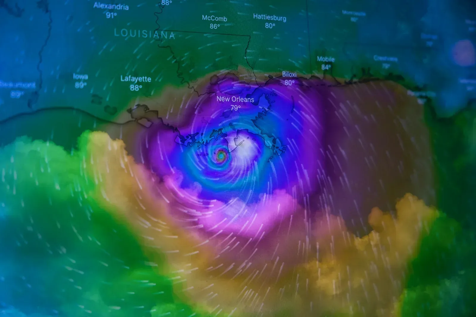
Hurricane Idalia formed in the Caribbean Sea on August 24, 2023, around 2:00 p.m., with initial winds of 28 km/h. The storm system proceeded northward at 13 km/h at first, eventually reaching a diameter of 815 kilometers. At 23:00 on August 26, 2023, the storm was named Idalia while it was still approximately 640 kilometers from the United States. It attained its peak wind speed of 111 km/h on August 28, 2023, at 14:00. This is equivalent to a hurricane of the tropical storm category.
Idalia made landfall near the town of Mantua, Cuba, at 8:00 p.m. on August 28, 2023. The storm had a wind speed of 111 km/h and a diameter of 289 kilometers when it arrived.
Officials in coastal villages urged with residents to evacuate immediately Tuesday, warning that high waters from the storm could be deadly and that first responders will be unable to assist until the storm passes. Some Floridians, however, are remaining put in order to rescue their homes and businesses while not leaving others behind.
“If you haven’t evacuated, you need to do so right now if you’re north of Fort Myers, up into the central Gulf Coast, northern Big Bend area.” “You need to stop what you’re doing, go to your room, pack your belongings, and get to safety,” Florida Division of Emergency Management Executive Director Kevin Guthrie advised Tuesday evening.
According to the hurricane center, the storm was a Category 2 storm with sustained winds of up to 110 mph late Tuesday long before midnight, centered about 120 miles southwest of Florida’s Cedar Key.
Its outer bands have lashed Florida for hours, producing flooding in several coastal areas. It is projected to grow further into a Category 4 hurricane, with sustained winds of at least 130 mph, before making landfall on Florida’s Big Bend coast Wednesday morning.
The hurricane center warned that “destructive life-threatening” winds will hit the area when Idalia’s core moves onshore. Storm surge flooding of 12 to 16 feet above ground level – high enough to stack a wall of seawater halfway up an average building’s second storey – and destructive waves might be “catastrophic.”
The hurricane center predicts that strong winds will move inland across northern Florida and southern Georgia near Idalia’s course, perhaps knocking out electricity along the way.
“There is a great potential for death and catastrophic devastation,” the Taylor County Sheriff’s Office said on Tuesday, ordering coastal residents to evacuate. “Storm surge on coastal regions is projected to be unsurvivable.” The county, located approximately southeast of Tallahassee, is part of the Big Bend region.
“That is storm surge that, if you’re there when that hits, it will be very difficult to survive,” Florida Gov. Ron De Santis warned in a news conference Tuesday evening.More than 7 million residents in central and western Florida, including Tampa, are also under a tornado watch.
The governor has advised to locals:–
Water, whether it is the storm surge that will occur at the coast or the heavy rainfall that may occur inland and cause urban flash flooding, is the No. 1 killer in all of these storms, according to the expert.
According to the National Oceanic and Atmospheric Administration, storm surge is to blame for almost half of all hurricane-related fatalities and the main cause of storm evacuations.
Residents were warned by state and local officials that it usually takes less distance to reach a safe location—tens of miles as opposed to hundreds of miles.
DeSantis stated, “You don’t have to leave the state. “Climb to a safe structure on higher ground. You can endure the weather there and return home.
Major emergencies and consequences:–
At least 28 counties have issued evacuation orders, some of which are mandatory, including Alachua, Baker, Citrus, Dixie, Franklin, Gilchrist, Gulf, Hamilton, Hernando, Hillsborough, Jefferson, Lafayette, Leon, Levy, Madison, Manatee, Marion, Nassau, Pasco, Pinellas, Putnam, Sarasota, Suwannee, Sumter, Taylor, Union, Volusia, and Wakulla. According to DeSantis, the counties of Citrus, Hernando, Hillsborough, Lake, Pasco, Pinellas, and Sumter are exempt from paying state tolls. The governor noted that there is at least one pet-friendly shelter in each county, pleading with people to “please take care of your pets.”
Major airlines have canceled hundreds of flights after commercial operations at Tampa International Airport were ceased on Tuesday and the terminal building at St. Pete-Clearwater International Airport was shuttered in the afternoon. At least 12 East Coast routes have been canceled by Amtrak, and more are being modified.
Declared emergencies: On Monday morning, DeSantis expanded an emergency declaration to 49 of the 67 counties in Florida. Additionally, a number of regional authorities have declared emergencies. Emergency declarations have also been made in Georgia, South Carolina, and North Carolina.
Outages are anticipated, and DeSantis warned locals to get used to being without electricity. The governor warned citizens on Sunday, “If you are in the path of the storm, you should expect power outages so please prepare for that.”
Hospital system ceasing operations: At least three hospitals—HCA Florida Pasadena Hospital, HCA Florida Trinity West Hospital, and HCA Florida West Tampa Hospital—will be used for patient transfers.
Categories of Hurricane:-
Category-1-74-95 mph
According to the National Oceanic and Atmospheric Administration, sustained winds are sufficient to tear vinyl siding and gutters off of houses and blow roof shingles off of them.
In addition to uprooting trees and bringing down branches, these winds can also cause power outages and additional property damage. They can also directly harm electricity wires.
In November 2022, Hurricane Nicole, a Category 1 hurricane, made landfall along Florida’s East Coast and had an impact on areas that were still recovering from Hurricane Ian, which had hit less than two months before. According to NOAA, Nicole significantly increased beach erosion and caused more than $1 billion in losses.
Category 2:- 96-110 mph:-
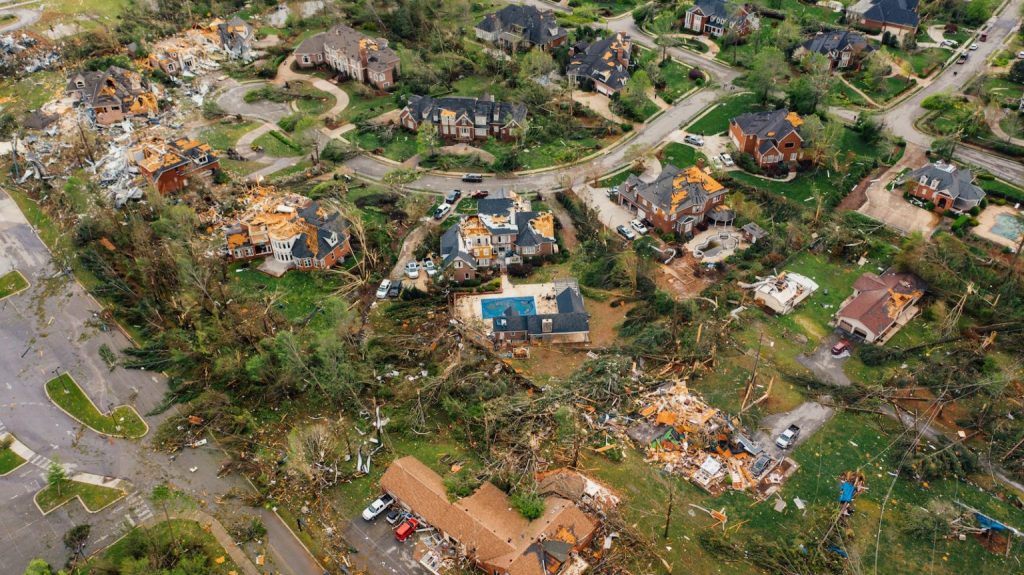
A home’s roof and siding might sustain significant damage from sustained winds, which have the potential to do up to 20 times as much damage as a Category 1 hurricane.
Most likely, numerous trees and electricity lines will be downed, obstructing traffic, causing property damage, and shutting out power for days to weeks.
Just 12 miles to the east of where Hurricane Laura had made landfall just six weeks previously, Hurricane Delta made landfall on the Louisiana coast in October 2020 with winds of 100 mph. In addition to severely harming trees, residences, and businesses, Delta also blew away many tarps from roofs that Laura had damaged. Additionally, South Louisiana received more than a foot of rain, which led to extensive flooding.
Category 3 :- 111-129 mph
Wind damage is far more pervasive now that we are in “major hurricane” zone. Roofs will receive significant damage, and even well-built homes and other structures may sustain significant damage. There will be extensive tree damage or uprooting. After the storm passes, “Electricity and water will not be available for several days to weeks,” according to NOAA.
During the busy 2005 Atlantic hurricane season, Hurricane Katrina, a Category 3 storm, made landfall. It originally touched down in Florida’s panhandle at Category 1 strength before quickly strengthening to Category 5 in the Gulf of Mexico. Before it could reach southeast Louisiana as a Category 3 hurricane, it began to lose strength.
Along the Mississippi-Alabama border, the storm surge was reported to be close to 20 feet, and estimated winds around Grand Isle, Louisiana, were as high as 140 mph. Many areas of New Orleans were flooded as a result of levee breaches, causing people to climb onto roofs to seek safety. According to NOAA, Katrina caused more than 1,800 fatalities, up to 600,000 home displacements for at least a month, and was the costliest hurricane ever.
Category 4:- 130-156 mph
In September 2022, Hurricane Ian made landfall as a Category 4 hurricane in the southwest Florida coast. It was the most expensive storm on record in Florida and claimed 150 lives. It was incredibly damaging due to its size and slow motion, with gusts of 150 mph battering coastal villages for hours.
According to NOAA, Ian produced a storm surge record estimated at 10 to 15 feet to Fort Myers and Naples. Unprecedented amounts of rain fell on Florida for days after the storm made landfall, leading to massive river flooding in the weeks that followed.
Category 5:- 157 mph or greater-
One of the worst storms to ever hit the United States was Hurricane Andrew in August 1992, which devastated an entire region after making landfall close to Homestead, Florida. According to NOAA, Andrew went from a Category 1 hurricane to a Category 5 storm in just 36 hours, with top speeds near Homestead of about 165 mph.
According to the National Weather Service, Andrew was at the time the “most expensive and destructive hurricane to ever strike the United States.”